

创作上传
VIP
收藏下载
登录 | 注册有礼
查看完整案例

收藏

下载

分享
翻译
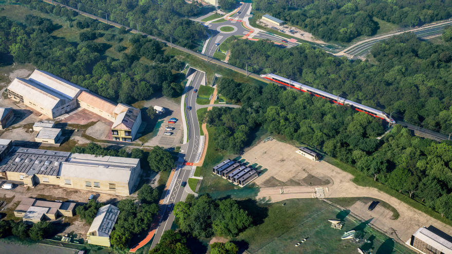
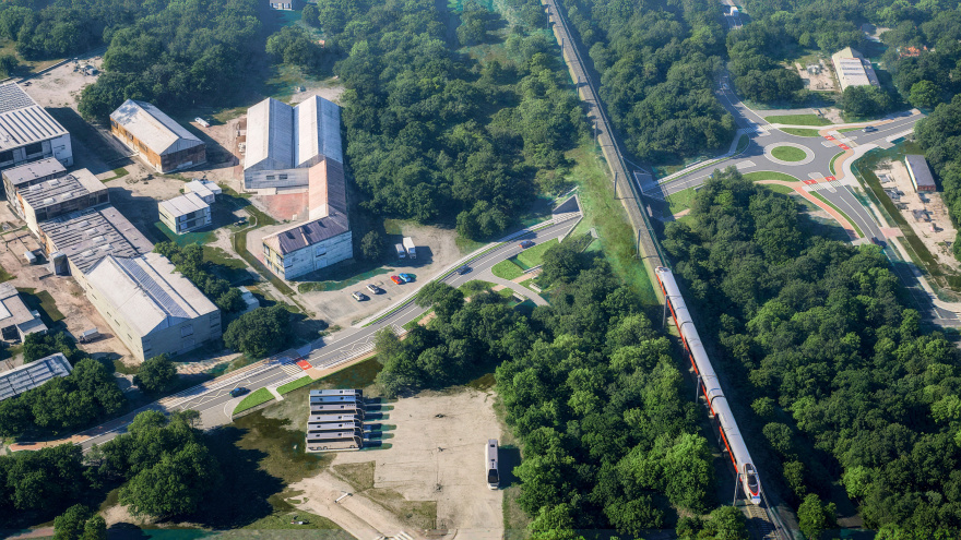
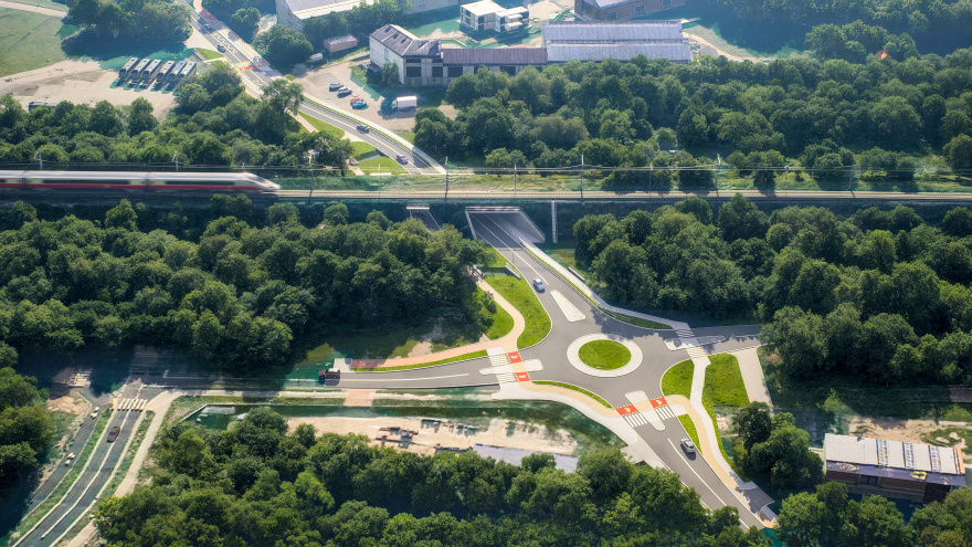
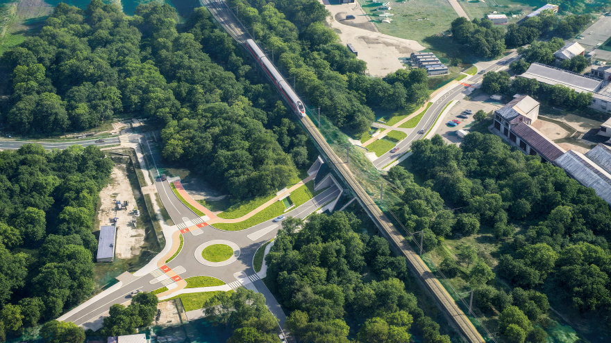
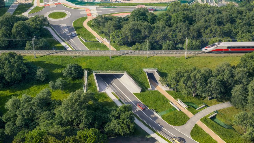
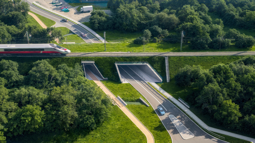
Under the Tracks - 3D Visualization of a Railway Viaduct Redevelopment (GIS + 3D)Tools used: Blender 4.5 + Cycles Render, QGIS, Affinity Photo, Darktable
The images below present a 3D visualization of a railway viaduct redevelopment, including a road tunnel/underpass beneath an active railway line. The scene was developed using GIS geospatial data and a Digital Elevation Model (DEM), combining spatial analysis with 3D environment creation and post-production.
The main objective was to show the design in its real-world context — with accurate terrain, existing vegetation, surrounding buildings, and the full road layout. Using georeferenced data helped preserve correct scale, alignment, and elevation relationships, resulting in a consistent and technically readable presentation.
Scope of work
- Review and preparation of input materials for building the 3D scene in full site context
- Road surface and proposed traffic layout modeling based on the provided site plan
- Viaduct / bridge elements modeled from engineering drawings (views and cross-sections)
- Railway embankment and terrain modeling, including existing greenery and nearby development
- Materials and texture development for key elements (asphalt, markings, structures, details)
- Scene dressing: vehicles, people, and supporting infrastructure elements
- Lighting setup and iterative test renders for look development
- Delivery of 6 static images, including at least three distinct viewpoints, plus post-production and color grading
南京喵熊网络科技有限公司 苏ICP备18050492号-4知末 © 2018—2020 . All photos and trademark graphics are copyrighted by their owners.增值电信业务经营许可证(ICP)苏B2-20201444 苏公网安备 32011302321234号
苏公网安备 32011302321234号客服
消息
收藏
下载
最近